Clark alumna demonstrates how GIS aids humanitarian responses to war and disaster

If you can’t be present at the scene of a crime, harnessing satellite imagery is one way to expose nefarious activities taking place thousands of miles away.
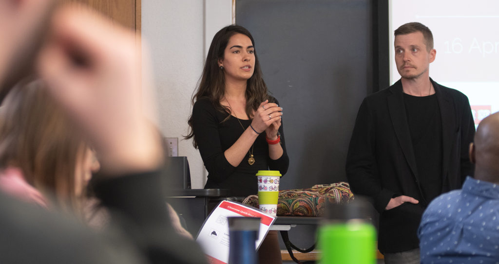
Saira Khan ’17, M.S. ’18, returned to Clark University in April to show how it’s done at the Harvard Humanitarian Initiative, a research center based at Harvard University’s School of Public Health. HHI conducts research and education “on the practice of relieving human suffering in war and disaster by advancing the science and practice of humanitarian response worldwide.”
Khan, an imagery analyst with HHI’s Signal Program on Human Security and Technology, and her supervisor, imagery analysis manager Isaac Baker, were invited guests at Professor John Rogan’s Advanced Remote Sensing class this spring. The course familiarizes students with the physical principles underlying remote sensing systems and related data-collection systems, as well as methods of interpreting and analyzing that data.
Baker explained that this technology, first deployed by the CIA in 1946 as a way to surveil Soviet Union activities, can also be used in humanitarian work. He and Khan spoke about several case studies using VHR (Very High Resolution) satellite imagery to discover and verify reports of conflict and violence around the world; the technology is particularly useful for monitoring events in countries that have closed their borders to foreign journalists and humanitarian workers, or cut off communication between their citizens and the outside world.
In regions of Sudan, Syria, and Nigeria, for example, they’ve used satellite imagery to distinguish between what might be a harassment bombing or a simple brush fire. Remote sensing technology also was used to verify reports of house-to-house killings in a mixed Muslim-Christian town, monitor population displacement, identify conditions that might lead to famine, identify mass graves, and make a case that prison inmates were being systematically murdered.
The mandate of the Signal Program is to ensure that information technologies — like remote sensing — are used not only effectively, but also safely and ethically.
Khan explained that the dissemination of information about violent conflict through public channels raises serious ethical questions. Is it okay to monitor people, even bystanders or victims, without their knowledge? Will the publication of violent events spur aid on behalf of the victims, or will it inadvertently show perpetrators other populations to terrify? Will perpetrators cut off public channels of communication, or camouflage their vehicles to conceal their presence?
During her time at the Signal Program, Khan has come to realize that technology has its limits. Human analysts are still required to provide context and meaning to a particular image. To make the best and most accurate use of the imagery, it’s ideal to have input from a witness on the ground.
A Phi Beta Kappa graduate who double majored in geography and international development and social change, Khan completed her master’s degree in geographic information science through Clark’s Accelerated B.A./Master’s Degree Program. As an undergraduate, she interned with the Worcester Refugee Assistance Project and for NOAA’s National Weather Service and Office for Coastal Management. While completing her master’s degree, she interned with HHI’s DisasterNet Program. Today, she uses VHR satellite imagery to identify and monitor vulnerable populations, migration, and structure damage.
Khan reflected on her return to the class in which she had been a student one year ago.
“It was great that the themes resonated with Clark students and inspired others to collaborate with us on ongoing projects,” she said. “The possible applications of geospatial technologies in the humanitarian sector are quickly evolving, and it’s encouraging to see the next generation of GIS and remote-sensing experts engage in this field.”
Attending the presentation were two student teams who had conducted research in partnership with HHI. Dale Watt ’17, M.S. ’19, and Kelly Janus, M.S. ’19, used satellite imagery to track changes in areas of Syria where atrocities had been known to occur. Andrew Walz, M.S. ’19, and Erica Issenberg ’18, M.S. ’19, explored the efficacy of a technique called segmentation to identify structures in refugee settlements in Jamtoli Bagonna, Bangladesh.
“The use of remote sensing in temporary refugee settlements can be an extremely beneficial way to detect change in this type of dynamic and chaotic landscape without having to gain ground access,” Issenberg said. “Through this partnership, I learned about the benefits of using remote sensing as a tool in humanitarian crises, as well as the challenges and issues that can accompany it.”
Janus noted, “While working on this project, my group and I tried to come up with what we thought was the best method to analyze the data given to us. Saira and Issac were extremely helpful to us. We had multiple meetings where we shared our findings and sought further advice.”
Rogan said the partnership with HHI grew out of Khan’s internship there as an undergraduate. “When Saira started at HHI post-graduation, I reached out to her to see if we could collaborate on a more official basis. It’s worked out really well and provided great real-world opportunities for the students to do important work.”


