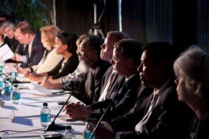
The Special Joint Committee on Redistricting at the State House in Boston, now grappling with the task of redrawing the political map of Massachusetts, received testimony from some Clark University political science undergraduates offering independent perspectives and “good government” redistricting models.
U.S. Census 2010 results released this spring reveal that the electoral map of Massachusetts – what one news columnist called “bizarrely contorted districts formed by decades of cynical political engineering” — has to be redrawn to include only nine congressional districts instead of the existing 10.
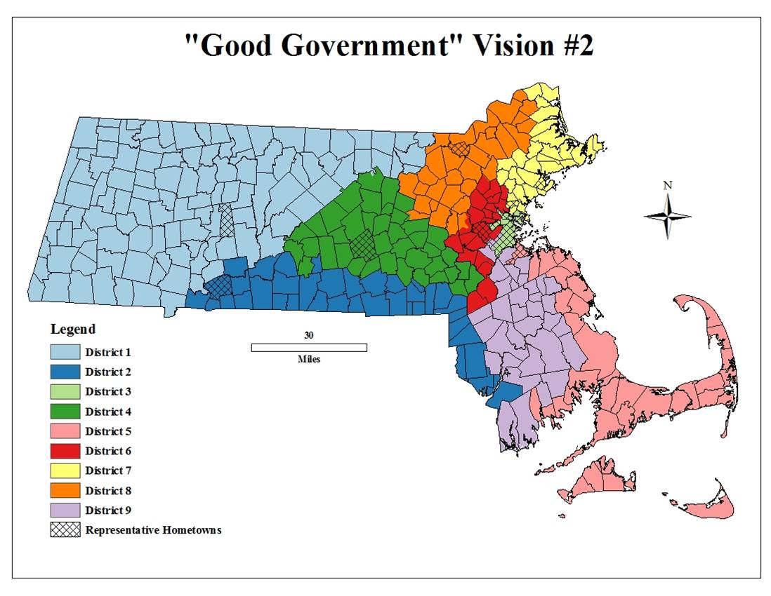
Clark students who took the spring-semester course “Congressional Districting: The Geography of Politics” submitted five congressional district maps as testimony to committee co-chairs Sen. Stanley C. Rosenberg and Rep. Michael J. Moran.
In a project bridging college-based research and real-world problem-solving, the students were asked by course co-instructors James R. Gomes, director of the Mosakowski Institute for Public Enterprise at Clark, and Robert G. Boatright, associate professor of Political Science, to use the new census data and Geographic Information System mapping technology to construct maps that, in the students’ judgment, would best serve the interests of the entire Commonwealth, as opposed to a “gerrymander” that would favor one party, interest, or incumbent rather than another.
“The testimony supports the argument that independent commissions, armed with modern computer software and data, can do a good, sensitive job at this task,” said Gomes. “Not necessarily better than what politicians do, but different.” For example, he said, the Clark students tended to pay less attention to incumbency protection or partisan gerrymandering than legislatures typically do.
* U.S. News & World Report listed this Clark course in its “10 College Classes That Impact the Outside World” feature on classes that “allow students to gain significant real-world experience before they graduate.” *
“We wanted the students to experience what legislatures and their staffs are going through all around America right now,” said Gomes. “They learned a lot about theories of representation and constitutional law, and they got a feel for how theory and practice come together in the real world.”
The submitted maps and text do not represent a recommendation or the official position of the University, he added.
The proposed Massachusetts maps reflect a variety of choices about how to define and recognize “communities of interest” and about how much weight line drawers should give to such factors and the compactness and shape of districts, keeping cities and towns intact within the same district, maintaining existing districts wherever possible, protecting incumbent members of Congress, and so on. The five options submitted are legally compliant and were done as if the students were an independent redistricting commission (an option the Massachusetts legislature has rejected).

The maps were based on data drawn from the Massachusetts Geographic Information Systems (MassGIS) office and the 2010 Massachusetts data from the U.S. Census Bureau. The students used ArcMap 10 and the Districting for ArcGIS extension software in constructing their maps.
“I felt like our map project really helped us appreciate how complicated the redistricting process really is,” said Nicholas Rossi, who will enter his senior year at Clark this fall. “The minute you get into the mapmaking process, you find yourself making compromises. There is no such thing as a perfect district map.
“When our groups had to make a ‘good government map’ that kept the best interests of the state and people in mind, everybody came up with similar yet significantly different results,” Rossi said. “What this class showed us is that everybody approaches the question of what is ‘good government’ in different ways.”
Besides Rossi, students participating in the “Congressional Districting: The Geography of Politics” course include: Ben August ’13, Ethan Cohen ’13, Marc Kadushin ’12, Brendan Labbe ’13, Jordan Langsam ’11, Amelia Najjar ’12, Colin Oldenburg ’11, Katherine Rowe ’12, Adam Shulman ’11, Jacob Stern ’12, Mark Vanderhoof ’13, David Wolfenson ’11 and Eleanor Zuckerman ’14. Several of them attended the state legislative committee’s Worcester-area regional hearing on redrawing districts, which was held on the Clark University campus in April.
“The redistricting course combined my interests in politics and geography,” said recent Clark graduate Shulman. “We examined theories of representation, judicial precedent, demographic data and contemporary politics, and it felt rewarding to apply this knowledge with the use of GIS. … I think this combination of practical and theoretical work will serve me well in government.”
Professor Boatright, who is also a former research fellow at the Campaign Finance Institute, recently published the book “Interest Groups and Campaign Finance Reform in the United States and Canada” (University of Michigan Press, 2011), about the ways in which limitations on interest group spending have changed American and Canadian political campaigns over the past decade.
“This year’s redistricting is the first where citizens can learn how to use the same mapmaking software that legislators are using,” Boatright said. “Our intention in teaching the course was to see whether students would be able to make the same sorts of careful decisions that legislators make. Our students showed that there is now the potential for redistricting to be far more democratic and open than it once was.”


